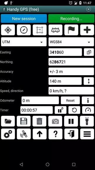
Get ready for your next outdoor adventure with Handy GPS lite! This powerful navigation tool is a must-have for hiking, biking, geocaching, and more. With no need for a user account or setup, simply install the app, turn on your GPS, and start exploring. Handy GPS lite works in remote areas without network connectivity and allows you to easily store waypoints, record track logs, and navigate to your destination. With features like current coordinates, altitude, speed, and compass guidance, this app is perfect for all your outdoor activities. Upgrade to the paid version for unlimited waypoints, offline maps, custom datums, and even more amazing features. Get Handy GPS lite now and never get lost on your adventures again!
Versatile Use: Handy GPS lite is a powerful navigation tool designed for a variety of outdoor activities such as hiking, biking, kayaking, and geocaching. It can also be used for surveying, mining, archaeology, and forestry applications.
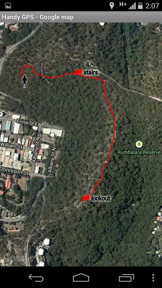
Works Offline: No need for network connectivity, Handy GPS lite can be used in the remotest backcountry. It allows you to work in UTM or lat/lon coordinates, making it compatible with paper topographic maps.
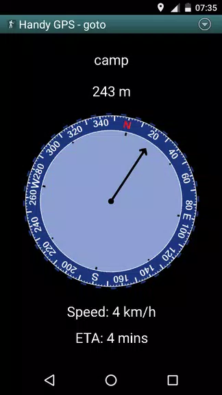
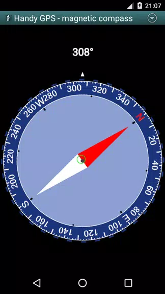
User-Friendly Interface: Handy GPS lite is simple to use, showing your current coordinates, altitude, speed, distance traveled, and direction of travel in metric, imperial/US, or nautical units.
Import and Export Data: You can easily import and export data from KML and GPX files, as well as manually enter waypoints in UTM, MGRS, and lat/lon coordinates.
What are the limitations of the free trial version of Handy GPS lite?
The free trial version only allows for storing 3 waypoints and 40 track log points. However, you can use the trial version for as long as you want before deciding to upgrade to the paid version.
Does Handy GPS lite require network connectivity to work?
No, Handy GPS lite does not require network connectivity, making it ideal for use in remote areas where there is no cellular service.
Can I use Handy GPS lite in different units of measurement?
Yes, Handy GPS lite can display coordinates, altitude, speed, and distance in metric, imperial/US, or nautical units, allowing you to choose the measurement system that suits your needs.
In conclusion, Handy GPS lite is a versatile and user-friendly navigation tool that is perfect for outdoor enthusiasts. With its offline capabilities, easy data import/export features, and compatibility with various coordinate systems, Handy GPS lite is a valuable companion for any outdoor adventure. Whether you're hiking, biking, or exploring the backcountry, Handy GPS lite has you covered. Download Handy GPS lite now and make your next outdoor adventure even more enjoyable and stress-free.