
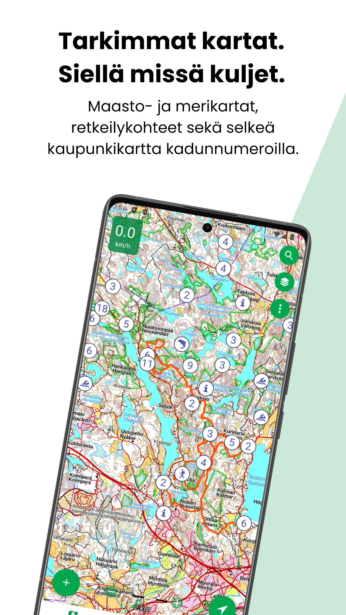


Karttaselain is an offline-capable mapping and GPS app that puts official topographic maps, aerial photos, and property information into your pocket. It’s ideal for hikers, boaters, landowners and anyone needing reliable location data: free national topographic maps and aerial imagery are available at no cost, while a Plus subscription unlocks detailed marine depth charts, continuously updated property records, offline downloads and device synchronization. Use Karttaselain to plan routes, track your position, save waypoints and access authoritative map layers when you’re offline or out in the field.
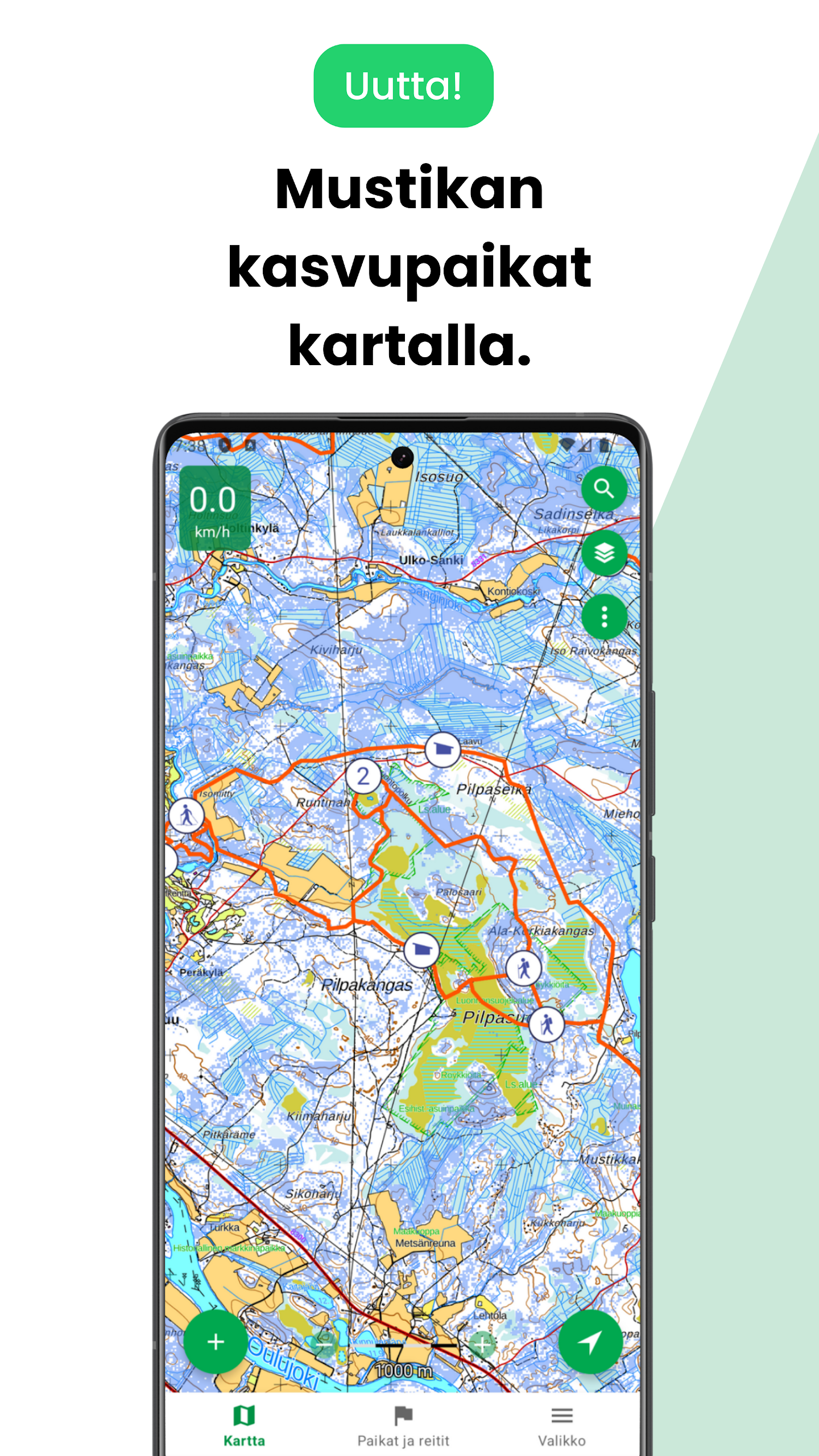
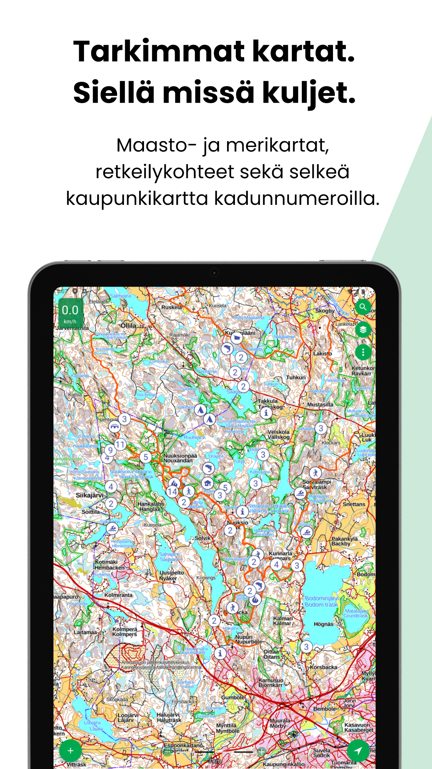
⭐ Official, up-to-date topographic maps from the national mapping agency and comprehensive aerial photos covering Finland.
⭐ Hiking and outdoor resources including shelters, ski trails and snowmobile routes plus a detailed Norwegian topographic map for cross-border trips.
⭐ Terrain and marine navigation tools: GPS positioning, track recording, compass and directional guidance, with basic depth and property layers included.
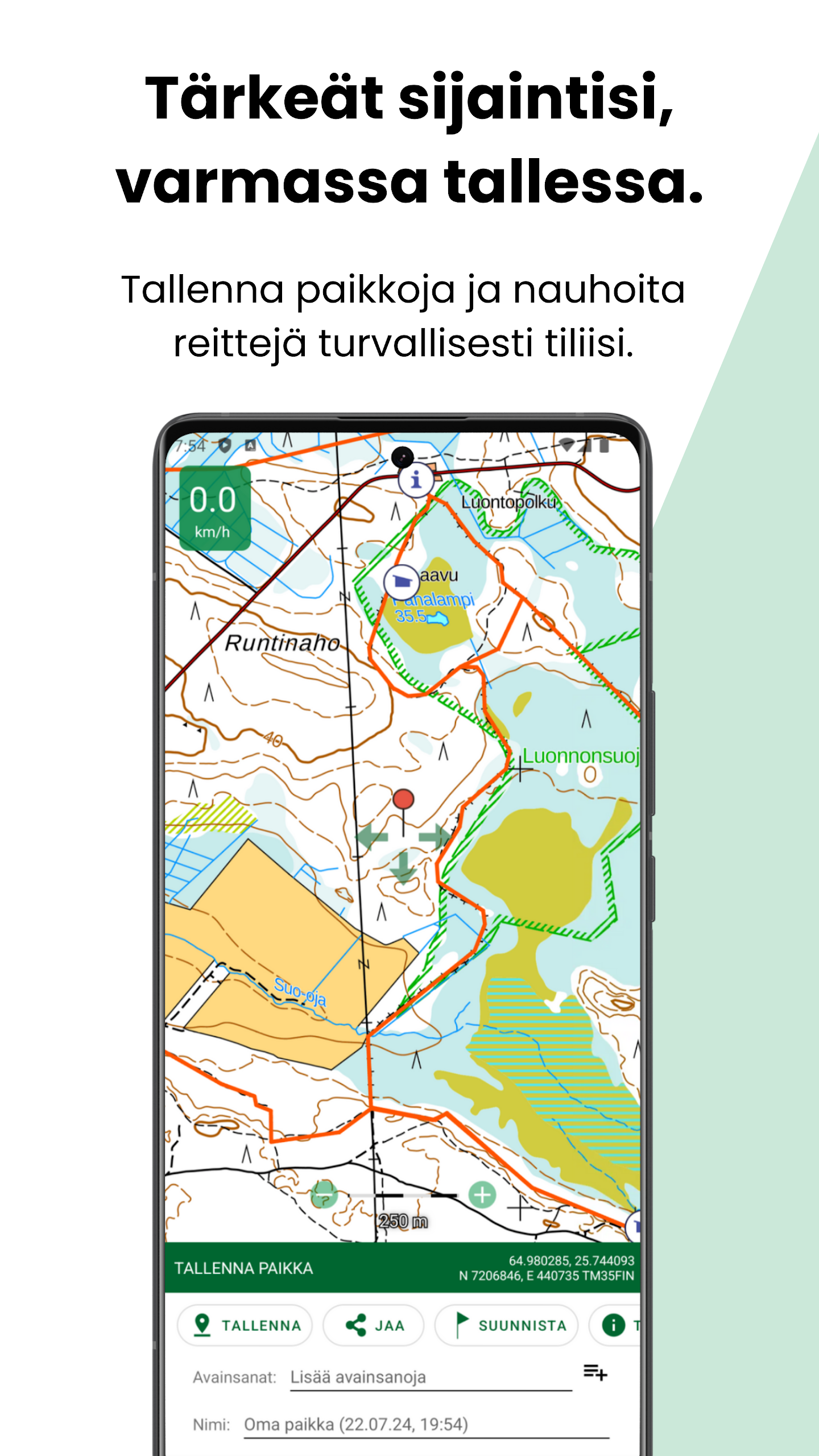
⭐ GPX import/export, place and route management, and a map feedback tool that lets users suggest map updates to the mapping authority.
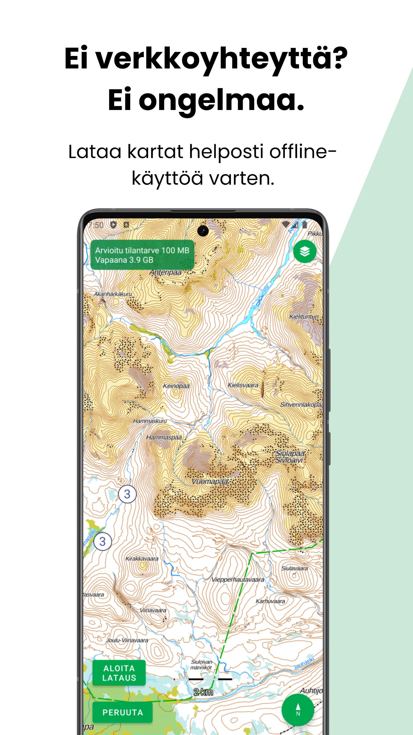
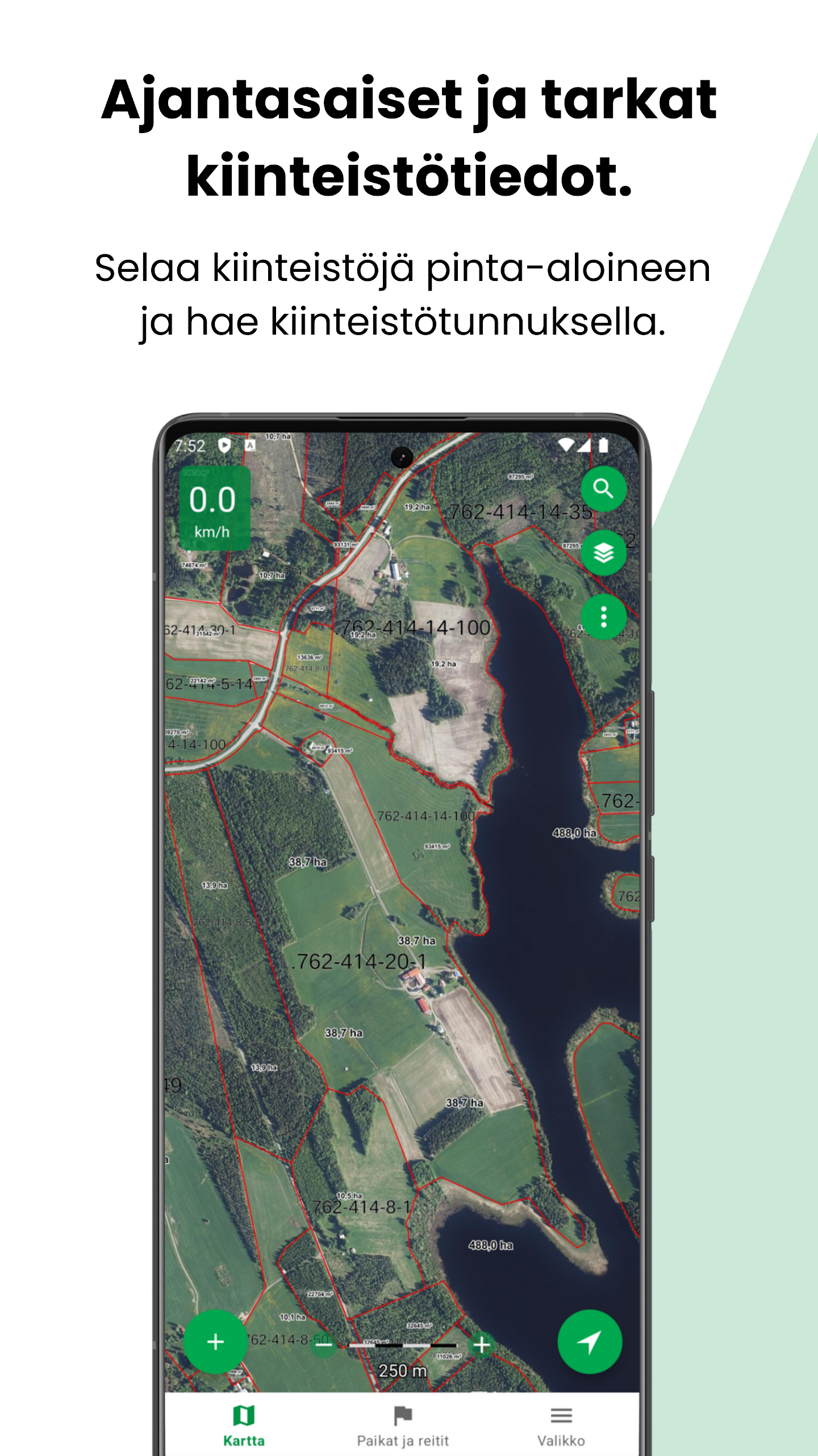
⭐ Plus subscription adds advanced marine depth charts, continuously updated property boundaries, hillshade and forest orthophotos, offline map downloads and cloud sync.
⭐ Support for tracking devices and pet or vehicle tracking, route planning and area calculation for measured regions.
✅ Offline map downloads make Karttaselain reliable in remote areas without mobile coverage.
✅ Official data sources ensure accurate topography, property outlines and updated marine information where available.
✅ A single subscription can be used on multiple devices and supports automatic synchronization between mobile and web versions.
✅ Beginner-friendly tools for saving waypoints, importing GPX routes and sharing locations, with customer support and an active user community contributing improvements.
✅ Flexible subscription options, including a free trial period and multi-device access for paid plans.
❎ Some advanced data—most detailed depth charts, continuous property updates and forest orthophotos—require a Plus subscription.
❎ Certain navigation features such as map rotation to travel direction and compass require device sensors (GPS and digital compass) to function fully.
❎ Coverage and primary data focus are centered on Finland, with additional Norwegian topographic coverage but limited global map depth.
Karttaselain is developed in collaboration with the national mapping authority and an active user community, combining official datasets with user feedback. The team provides customer support and gathers suggestions from users to improve map accuracy and usability.
The latest updates introduce slope shading and forest orthophotos to enhance terrain visualization; these layers are available to Plus subscribers or during the trial period after updating the app to the current release.