

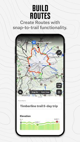
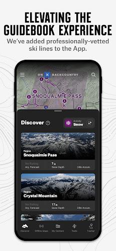
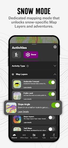
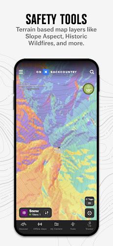


Introducing onX Backcountry Snow/Trail GPS, the ultimate GPS mapping app for all your outdoor adventures. Whether you're an avid skier, hiker, runner, mountain biker, or backpacker, this app has everything you need. With over 650,000 miles of trails and 4,000+ ski routes nationwide, you can easily find the perfect trail or ski line for your next outing. But it doesn't stop there—onX Backcountry Snow/Trail GPS also offers powerful planning tools to help you prep better for your trips. With a 3D map, you can visualize the terrain, scout lines, and plan for potential hazards. You can also access reports from other trail users and get winter snow information from SNOTEL stations and regional avalanche forecasts. Building custom routes is a breeze with snap-to-trail functionality, and leaving notes on key points is as simple as dropping waypoints. And the best part? You can navigate without cell coverage by saving offline maps to your device. Turn your phone into a handheld GPS device and always know how to get home, no matter where you are. The app also provides the best maps out there, with data sourced from USFS, BLM, and NPS. You can view the maps in 3D, topo, satellite imagery, or a hybrid, and elite users even have access to private landowner data and recent satellite imagery. With the app, you can explore and enjoy the great outdoors with confidence. Try it for free today and unlock a whole new level of outdoor adventure.
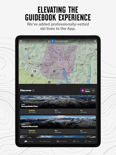
> Comprehensive Trail and Ski Line Information: Whether you're skiing, hiking, running, mountain biking, or backpacking, this app provides nationwide coverage with over >000 miles of trails and >000+ ski routes.
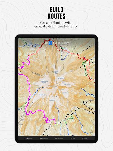
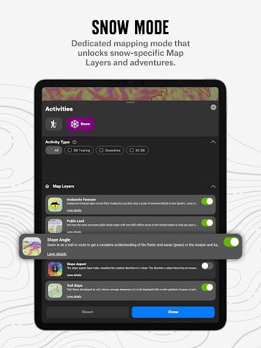
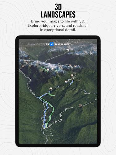
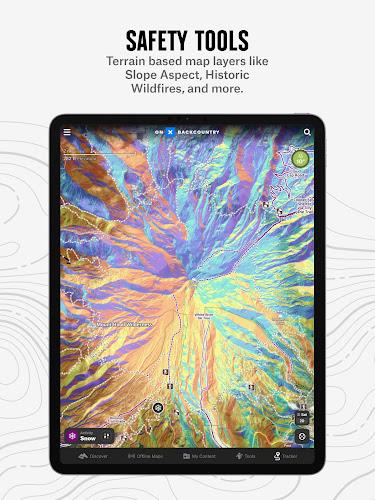
> Powerful Planning Tools: Plan your outdoor adventures in three dimensions with a 3D map that allows you to visualize terrain, scout lines, and plan for hazards. Get recent conditions from other trail users and access winter snow info from SNOTEL stations and regional avalanche forecasts.
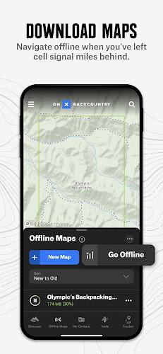
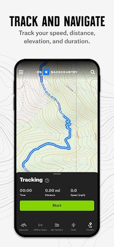
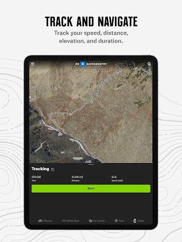
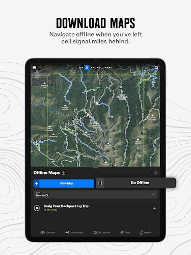
> Offline Navigation: Download offline maps to navigate even without cell service. Turn your phone into a handheld GPS device using the app's internal GPS. Leave a breadcrumb trail to track your location, speed, distance, and elevation gain.
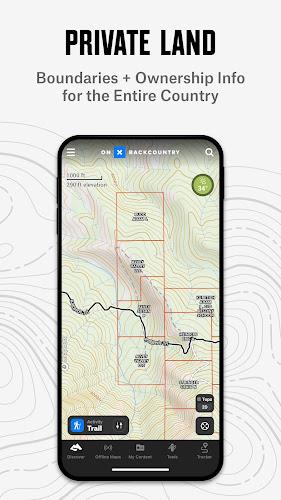
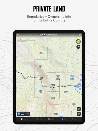
> High-Quality Maps: The app's color-coded basemap, sourced from USFS, BLM, and NPS, helps you easily find what you're looking for. View your maps in 3D, topo, satellite imagery, or a hybrid. Elite users have access to private landowner data and recent satellite imagery.
> Premium and Elite Features: Access over >000 miles of trails, >000+ backcountry ski lines, avalanche forecasts, snowfall information, route builder, unlimited offline maps, photo waypoints, trip tracking, localized weather conditions, private land layer, recent imagery, and 985 million acres of public land.
> Free Trial: When you install the app, you get a free trial of the premium or elite features for seven days. This includes 3D maps, unlimited offline downloads, rich trail data, and guidebook ski lines.
OnX Backcountry Snow/Trail GPS is the ultimate GPS mapping app for outdoor enthusiasts. It offers comprehensive trail and ski line information, powerful planning tools, offline navigation, high-quality maps, premium and elite features, and a free trial. Download the app now to enhance your outdoor adventures and explore new trails.