

Nature Path Guide helps hikers and outdoor enthusiasts plan, navigate, and discover trails with offline maps, route planning, and real-time waypoint guidance. The app combines detailed topographic data, user-contributed trail notes, and turn-by-turn navigation so you can explore safely and confidently across parks, forests, and backcountry paths.
Nature Path Guide brings together practical tools for trip preparation and on-trail navigation. Offline topographic maps let you keep full map detail without a data connection. The route builder supports multi-point itineraries and estimated time calculations. Live GPS tracking logs your progress and exports standard GPX/KML files for sharing or backup.
The interface is designed for quick access while on the move. Large map gestures, a responsive zoom wheel, and one-tap layer switching make it simple to change between topographic, satellite, or hybrid views. Map labels and icons scale with zoom to reduce clutter, and a compact status bar shows elevation, distance to destination, and estimated time remaining.
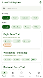
Planning a trip begins with selecting a start and end point, then adding waypoints to mark campsites, viewpoints, or water sources. The planner calculates elevation profiles and suggests pacing based on terrain. When you start navigation, turn-by-turn directions appear alongside a visual map trace. If you stray from the planned route, the app recalculates and offers the most efficient return path.
Customize the display with map themes, color-coded routes, and optional safety reminders. Nature Path Guide includes a suite of safety features: shareable live location links, an automatic SOS trigger when stationary beyond a threshold, and the ability to attach photos or notes to waypoints. These tools help you communicate plans with friends and enable quicker assistance if needed.
Built-in syncing keeps your routes, favorites, and notes available across devices. You can export trips as GPX for use with other apps or import community routes to explore new areas. If you prefer privacy, the app supports local-only storage so your trails and logs remain on-device without cloud backup.
Optimized for battery efficiency, the tracking engine minimizes GPS usage while maintaining location accuracy. Map tiles cache intelligently to reduce repeated downloads and to keep a compact footprint on your device. The app runs smoothly on a wide range of Android devices, and map packages are sized so you can choose regional downloads rather than entire-country bundles.
To start using Nature Path Guide, download the regional map for your planned area, create a simple route with a few waypoints, and take a short local walk to get familiar with screen controls and notification settings. Test the live location share with a friend before heading out on longer trips, and enable offline maps when cellular coverage is uncertain.
Nature Path Guide balances robust mapping features with an approachable workflow. Whether your outings are short day hikes or multi-day backcountry treks, the app provides the tools to plan routes, monitor progress, and maintain safety without overwhelming the user interface.