



Austin Transit - Bus & Train is a focused travel app for navigating Austin’s public transportation network. It provides real-time bus and train schedules, route planning, stop information, and live arrival predictions so commuters and visitors can plan efficient trips across the city with up-to-date transit data.
Austin Transit - Bus & Train combines official timetable data with live vehicle locations to deliver accurate arrival times and easy-to-follow itineraries. The app aims to reduce wait times and uncertainty by offering step-by-step directions, service alerts, and clear route maps tailored to local transit, including buses, light rail, and paratransit options.
The app includes a compact set of tools designed for everyday commuting:
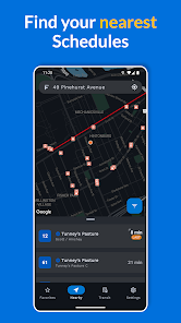
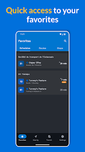
The interface emphasizes clarity: a search bar for addresses and stops, a map centered on the user’s location, and a timeline view for upcoming departures. Common tasks follow a simple flow—search a destination, choose a suggested itinerary, and follow turn-by-turn guidance. Favorite routes and recent searches are surfaced to speed up repeated trips.
Trip planning focuses on minimizing total travel time. Users can compare options by arrival time, number of transfers, and walking distance. The planner shows alternate routes when one service is delayed, making it easy to switch to a faster connection. For commuters, saved trips can be checked at a glance each morning.
The integrated map displays current vehicle locations, stops, and route lines with clear color-coding. Map layers let you toggle transit, traffic, and bicycle-friendly paths, helping you combine modes of transport. Zooming into a corridor reveals detailed stop layouts and platform information for rail services.
Notifications are configurable by route and stop so you only get the updates that matter. Choose push alerts for major disruptions, or enable quiet reminders for boarding times to avoid missing a connection. Alert history keeps a short log of recent advisories for review.
Built to be responsive on a range of Android devices, the app minimizes battery drain by adapting location update frequency based on whether you’re actively navigating. Data usage is optimized by compressing map tiles and allowing users to restrict background syncing. The app supports popular Android versions and scales well from phones to tablets.
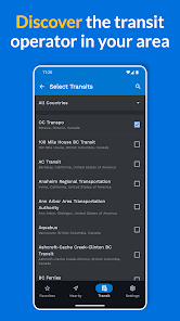
Accessibility options include high-contrast modes, large text support, and voice-over-friendly labels to assist riders with visual impairments. Integration with local transit agencies provides official schedule updates and service notices directly inside the app, ensuring consistency with posted timetables.
Begin by granting location permission to center the map on your position. Add frequently used stops to Favorites and run a few test searches to become familiar with route suggestions. Enable push notifications for the routes you rely on and pin the app to your home screen for fast access before heading out.
For smoother journeys, allow a buffer when planning transfers, check alerts before peak travel times, and use saved offline timetables when entering areas with poor reception. When possible, compare two suggested itineraries—sometimes a slightly longer walk reduces total wait time.
For daily commuters, visitors, and occasional riders, the app streamlines travel across Austin’s transit network with reliable live data, clear navigation, and customizable alerts. Its focus on practical features and efficient performance makes it a useful companion for planning trips by bus and train around the city.